43kmLINEAL ROUTEST. FELIU DE GUÍXOLS - BEGUR

    • DISTANCE

      43.0 Km

    • ELEVATION +

      1226 m

    • EFFECTIVE TIME

      11h 13 min

    • APPROXIMATE TIME

      13 h 24 min

    LINEAL 3 DAYS
    Camera

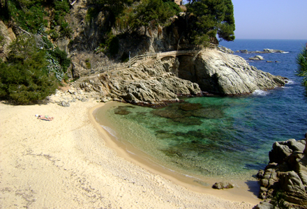
    Cala de la Roca del Paller - Primavera 2014

    LINEAL 3 DAYS
    Camera

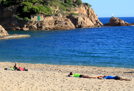
    Tamariu - Tardor 2014

    LINEAL 3 DAYS
    Camera

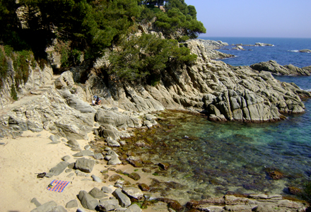
    Cala dels Esculls - Primavera 2015

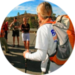
    Walk 43km in three days (an average of 14km per day). Suitable for anyone who is used to hiking occasionally (3 DAYS, 2 NIGHTS)


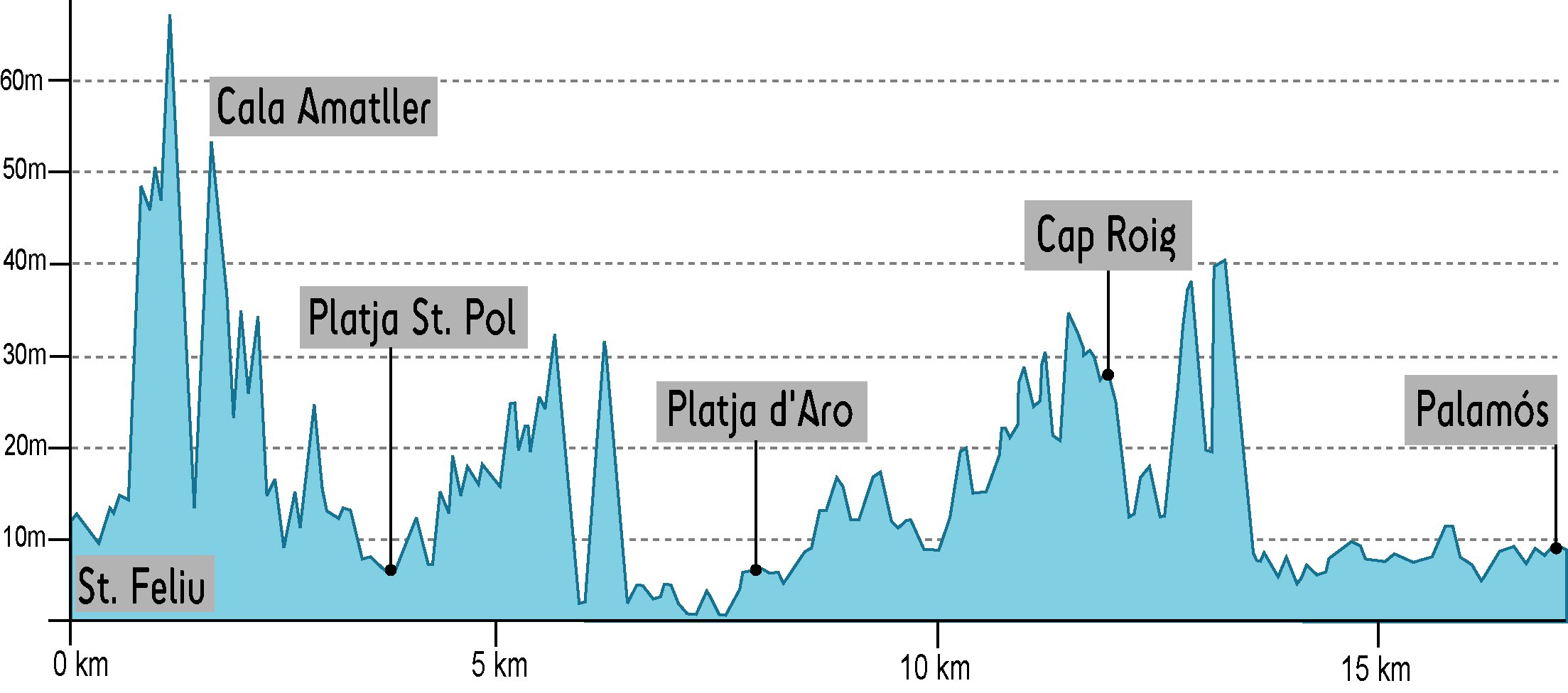
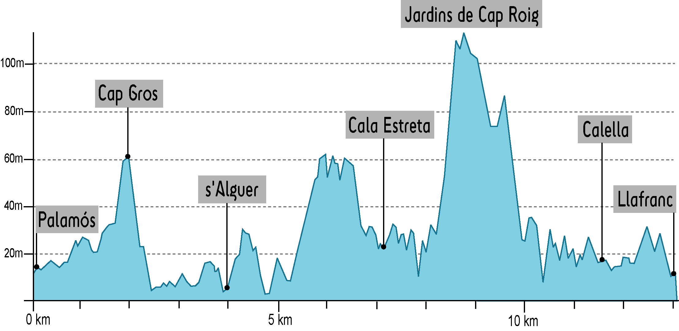
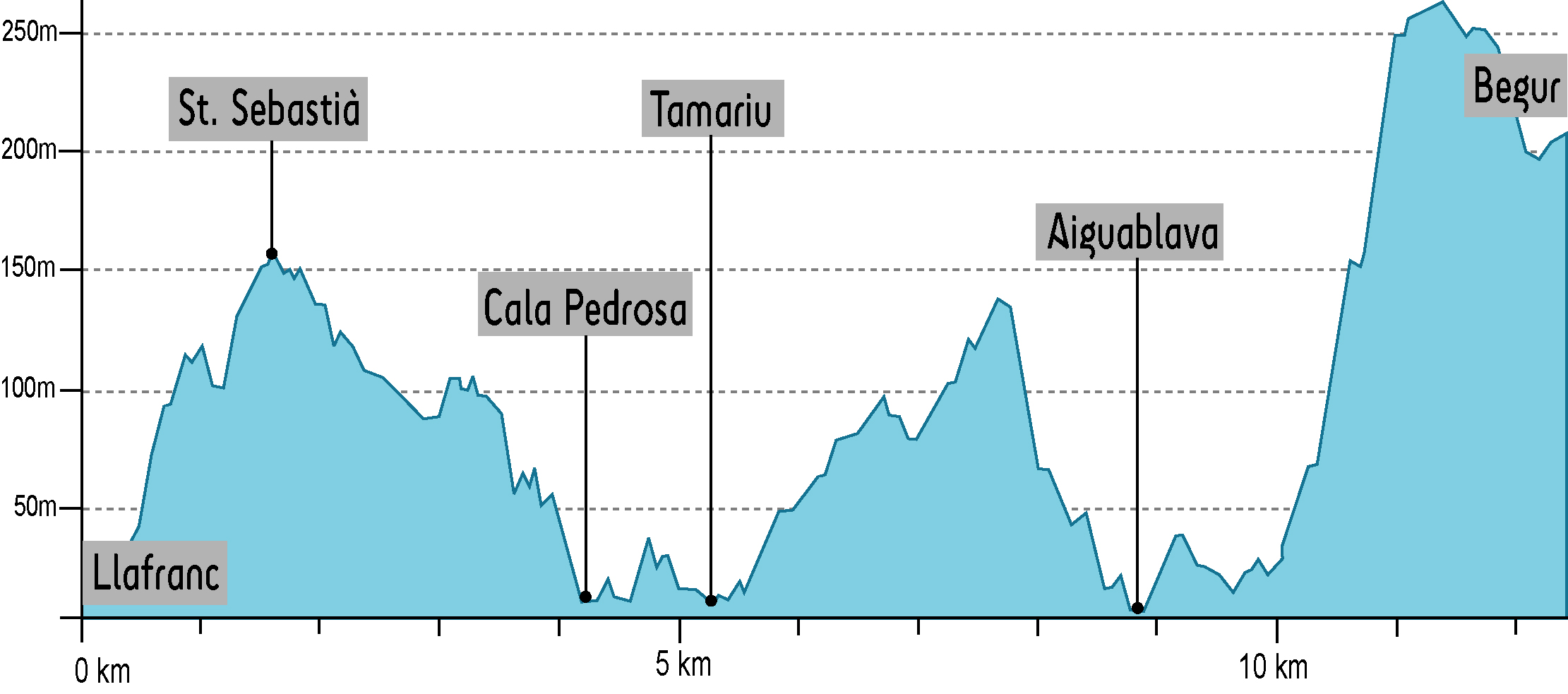
    Route specially designed for people who walk sporadically and who have three days off at any time of the year. The route is spectacular as it passes through the best beaches and coves on the Costa Brava. On the first day it is advisable to enjoy the stretch of Camí de Ronda® de s’Agaró and stop at Cala del Pi. On the second day it is recommended to stop at s’Alguer, Cala dels Corbs, Cap de Planes, El Crit or El Golfet. On the third day it is essential to bathe in Cala Pedrosa, jump on the historic trampoline of the barraca dels Lliris de Tamariu or swim in the paradisiacal waters of Aiguablava beach.

  • DAY 1: St. Feliu de Guíxols - Palamós

    DISTANCE
    17.4 Km
    ELEVATION +
    227 m
    EFFECTIVE TIME
    4 h 30 min
    APPROXIMATE TIME
    5 h 25 min

    Starting at the village of Sant Feliu de Guíxols and along the coast we will go through cala del Molí, cala Maset and Sant Pol beach. Next, we will find S’Agaró, where Camí de Ronda® became a planned novocentist promenade, designed by architect Rafel Masó in 1916. The route continues to Sa Conca beach and then surrounding the mouth of Ridaura river, we reach the village of Platja d’Aro. We go through this village along the promenade towards Sant Antoni de Calonge. The next stretch is impressive, since Camí de Ronda® becomes a narrow path that twists between cliffs, crystal-clear coves and thick-sand beaches. The stretch of Sant Antoni de Calonge to Palamós is a nice promenade throughout the seaside. 

  • DAY 2: Palamós-Llafranc

    DISTANCE
    13.1 Km
    ELEVATION +
    344 m
    EFFECTIVE TIME
    3 h 23 min
    APPROXIMATE TIME
    4 h 05 min

    We leave Palamós behind and after crossing cala Margarida we climb the cap Gros. The views from this point are excellent. Short after this point, we reach la Fosca beach, with the ruins of Sant Esteve castle. From this point on, the wildest stretch of Camí de Ronda® starts. We reach s’Alguer, small fishermen place of traditional Mediterranean architecture; the Castell beach, one of the only virgin beaches of Costa Brava, cala Canyers, cala dels Corbs, cala Estreta, cap de Planes and el Crit. Then, we climb cap Roig, to reach Golfet beach and we barely notice we enter Calella de Palafrugell. We continue to Llafranc.

  • DAY 3: Llafranc-Begur

    DISTANCE
    12.5 Km
    ELEVATION +
    655 m
    EFFECTIVE TIME
    3 h 20 min
    APPROXIMATE TIME
    3 h 54 min

    When leaving Llafranc, we find a sharp uphill to the mount of Sant Sebastià lighthouse, the most powerful one in the peninsula, a chapel, a watchtower with medieval origin and the remains of an iberic settlement. From this point, beneath the Cliff known as salt de Romaboira, the views of the coast are impressive. We take a narrow path towards cala Pedrosa and then twist over the cliffs towards Tamariu. From this point, we will go through narrow ways, leading us into the woods, until we reach Aiguablava beach, ses Orats port and Fornells. To end up, after a sharp and sustained uphill, we reach Begur.